
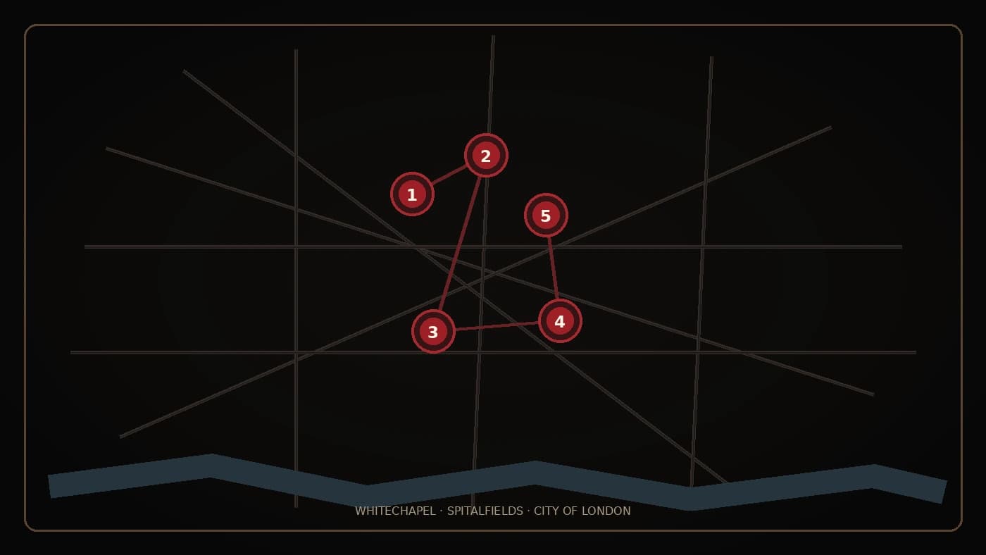
The Jack the Ripper murder sites are closer together than most visitors expect. The five locations most widely associated with the same killer sit across Whitechapel, Spitalfields and the eastern edge of the City of London. Streets have been renamed, buildings have disappeared and whole blocks have been rebuilt, but the geography of the case can still be traced today.
This guide maps the five canonical murder sites, explains what each place is called now and shows what remains in modern London. It focuses on the women and the historical landscape rather than graphic detail. Where an original building or yard has vanished, the position shown is necessarily approximate.
Explore the five canonical sites
Select a numbered marker to identify the victim, historic site and modern location. The red line follows the sites in chronological order; it is not a recommended route through private property.
- 1Buck’s RowMary Ann Nichols · Durward StreetGoogle Maps ↗
- 229 Hanbury StreetAnnie Chapman · Hanbury StreetGoogle Maps ↗
- 3Dutfield’s YardElizabeth Stride · Henriques StreetGoogle Maps ↗
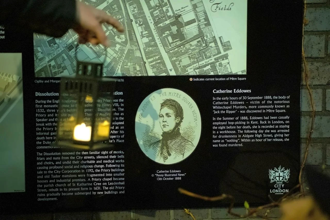
- 4Mitre SquareCatherine Eddowes · Mitre SquareGoogle Maps ↗
- 5Miller’s CourtMary Jane Kelly · Former Dorset Street areaGoogle Maps ↗
Pins show approximate historic positions. Several original yards, buildings and street lines no longer exist.
The Five Canonical Jack the Ripper Murder Sites
The term “canonical five” refers to Mary Ann Nichols, Annie Chapman, Elizabeth Stride, Catherine Eddowes and Mary Jane Kelly. They were killed between 31 August and 9 November 1888. Other deaths formed part of the wider Whitechapel Murders investigation, but historians continue to debate whether they were connected to the same person.
The five-site map is therefore not a map of every Whitechapel murder. It is the most commonly accepted geographical outline of the crimes attributed to Jack the Ripper.
Research note: The surviving Metropolitan Police case papers are catalogued by The National Archives as MEPO 3/141, covering the Whitechapel murders from 1888 to 1894.
1. Buck’s Row, Now Durward Street — Mary Ann Nichols
Date: 31 August 1888Modern location: Durward Street, near Whitechapel stationOpen in Google Maps ↗
Mary Ann “Polly” Nichols was found on Buck’s Row in the early hours of 31 August. The street was later renamed Durward Street and still runs just north of Whitechapel Road.
The setting is very different today. Railway works, housing and repeated redevelopment have replaced much of the 1888 streetscape. The modern road marks the correct historic area, but there is no intact Victorian crime scene to enter. That contrast is important: the location survives, while the physical world around it largely does not.
2. 29 Hanbury Street — Annie Chapman
Date: 8 September 1888Modern location: Hanbury Street, SpitalfieldsOpen in Google Maps ↗
Annie Chapman was found in the backyard of 29 Hanbury Street. In 1888, the road was lined with narrow houses, workshops and crowded yards. It ran through a district shaped by migration, tailoring, market work and severe housing pressure.
The original number 29 was demolished, so visitors cannot stand in the old yard. Hanbury Street itself remains, cutting east from Commercial Street towards Brick Lane, but the northern side has been substantially rebuilt. Nearby streets and surviving Victorian buildings still help explain how enclosed and densely occupied the area once felt.
For the wider social background, read what Whitechapel was really like in 1888.
3. Dutfield’s Yard, Off Berner Street — Elizabeth Stride
Date: 30 September 1888Modern location: Henriques Street, near Fairclough StreetOpen in Google Maps ↗
Elizabeth Stride was found in Dutfield’s Yard, a narrow entrance beside the International Working Men’s Educational Club on Berner Street. Her death was the first of two that night, an episode later known as the “double event”.
Berner Street was renamed Henriques Street. Dutfield’s Yard and the original club building have gone, and the surrounding block has changed substantially. The junction with Fairclough Street gives the clearest modern reference point, but the exact historic yard is no longer visible as it appeared in 1888.
4. Mitre Square — Catherine Eddowes
Date: 30 September 1888Modern location: Mitre Square, near AldgateOpen in Google Maps ↗
Catherine Eddowes was found in Mitre Square less than an hour after Elizabeth Stride. This was the only one of the canonical five murders committed within the City of London rather than the Metropolitan Police district, which meant two police forces became involved that night. The City of London’s official walking guide also records Catherine Eddowes at Mitre Square.
Mitre Square is the easiest name on this list to find on a modern map because the square still exists. Its buildings and layout have changed through successive redevelopments, so the present-day space should not be mistaken for a preserved Victorian scene. Even so, standing there makes the compact geography of the case immediately clear: Whitechapel, Aldgate and the City meet within a short walk.
5. Miller’s Court, Off Dorset Street — Mary Jane Kelly
Date: 9 November 1888Modern location: the former Dorset Street area beside Commercial Street and Spitalfields MarketOpen in Google Maps ↗
Mary Jane Kelly was killed in the room she rented at 13 Miller’s Court, reached through a passage from Dorset Street. Unlike the other canonical sites, this was an indoor location.
Dorset Street was later renamed Duval Street and then disappeared during redevelopment. Miller’s Court no longer exists, and the former street line has been absorbed into the modern buildings around the old London Fruit and Wool Exchange site. Visitors can identify the general position near Commercial Street, but there is no surviving room, court or original frontage.
The nearby Ten Bells remains one of the area’s best-known historic landmarks. Its connection to the case should be treated as part documented history and part later tradition, rather than as proof of where the killer went. Historic England’s Grade II listing documents the pub’s mid-nineteenth-century building and coloured tiled interior.
What Still Survives from Whitechapel in 1888?
Very little survives unchanged at the five murder sites themselves. The value of visiting comes from seeing the distances, street pattern and remaining Victorian landmarks together. Around the wider area you can still find nineteenth-century terraces, churches, market buildings, pubs and narrow passages that help place the documentary record in a real landscape.
- Street names that changed: Buck’s Row became Durward Street, and Berner Street became Henriques Street.
- Locations that disappeared: Dutfield’s Yard and Miller’s Court no longer exist.
- A location that kept its name: Mitre Square remains on the map, although it has been rebuilt.
- A surviving landmark: the Ten Bells still stands on Commercial Street.
Our guide to historic Jack the Ripper pubs in Whitechapel covers several surviving places associated with the district’s social history.
Can You Visit the Jack the Ripper Murder Sites Today?
Yes. All five historic areas can be reached using public streets, although some exact positions are approximate and several original buildings have vanished. Mitre Square is a public space; the other sites are on or near ordinary streets and modern developments.
Please remember that these were the places where real women lost their lives. Visit quietly, avoid disturbing residents or businesses, and do not enter private property. A responsible visit should make the history clearer without turning the locations into a spectacle.
Why a Map Cannot Tell the Whole Story
A map shows that the locations were tightly clustered. It cannot show how dark, crowded and socially divided the East End was, or explain the lives of the women moving through it. For that, the murder sites need to be understood alongside lodging houses, workhouses, markets, pubs, police boundaries and the rapid growth of Victorian London. The LSE’s guide to Charles Booth’s poverty maps explains how streets were classified, while the London Museum’s 1889–91 map shows the social character of Spitalfields and Whitechapel.
It is also worth separating where the women lived from where they died. Our article on the lives and addresses of the five canonical victims adds that missing human geography.
Explore the Locations with a Guide
Street names, police boundaries and demolished alleys can be difficult to reconstruct while looking at modern buildings. Our Jack the Ripper walking tour in London connects the surviving streets with the evidence, the social history of Whitechapel and the lives of the victims. Rather than simply pointing at locations, our guides explain what was there in 1888, what has changed and which popular claims are disputed.
Frequently Asked Questions
Where are the Jack the Ripper murder sites?
The five canonical sites are Buck’s Row, now Durward Street; 29 Hanbury Street; Dutfield’s Yard off Berner Street, now Henriques Street; Mitre Square; and Miller’s Court off the former Dorset Street. They lie across Whitechapel, Spitalfields and the eastern edge of the City of London.
Do the original murder sites still exist?
The geographical locations can still be identified, but most original buildings and yards have been demolished. Mitre Square retains its historic name, while Durward Street, Hanbury Street and Henriques Street preserve the broader street locations. Miller’s Court and Dorset Street have disappeared.
Can you walk between all five locations?
Yes, but the sites are not arranged as a simple straight route, and the most meaningful path depends on which historical landmarks and pieces of evidence you want to include. Modern traffic, private property and redevelopment also make the 1888 geography less obvious than it appears on a map.
Which Jack the Ripper site is best preserved?
None is preserved as an intact crime scene. Mitre Square is the most straightforward location to identify by its historic name, but the present square has been redeveloped. The wider Whitechapel and Spitalfields district contains more surviving Victorian character than the individual sites themselves.
Why are only five sites shown?
These are the sites associated with the “canonical five”, the group most commonly attributed to the same unidentified killer. The official Whitechapel Murders file included additional victims, and historians still debate which cases were connected.
Sources and Further Reading
- The National Archives: Metropolitan Police Whitechapel murders file, MEPO 3/141
- The National Archives: records and historical context for the Whitechapel murders
- City of London: Mitre Square and Catherine Eddowes
- Historic England: official Grade II listing for the Ten Bells
- LSE Library: Charles Booth’s Maps Descriptive of London Poverty
- London Museum: Descriptive Map of London Poverty, 1889–91
- Casebook: interactive map of the murder locations